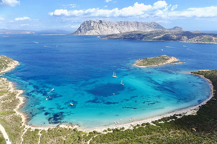
40° 53′ 00″ N; 09° 40′ 00″ E
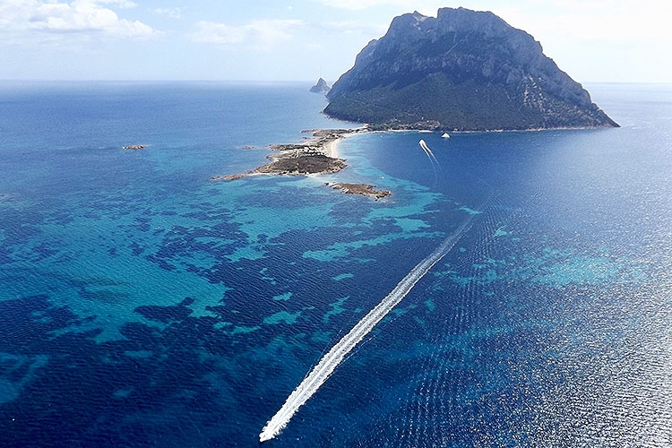
The impressive limestone massif overlooking the sea, a symbol of this
sea area, is a picturesque and magical location. The vertical part of the
island evens out to the west in the pink-white sandy strip, offering optimal
seabed conditions for anchoring, sheltered from the dominant winds, in a wild
and isolated nature. In mid-July the Tavolara Film Festival takes place. The
seabed offers extraordinary landscapes for diving enthusiasts.
40° 51′ 00″ N; 9° 42′ 00″ E
The granite island of Molara is a fascinating wild site, rich of rocky
inlets and bays that offer shelters, landscapes and a spectacular seabed in the
typical Mediterranean vegetation.
The island, home to wild cattle, is a nesting ground for several species
of sea birds, such as the peregrine falcon, the shearwater and the Corsican
seagull.
In the north-west of the island, in Piscine di Molara, a vast pool of
water with white sandy seabed, water is of a unique turquoise color.
Fulco Pratesi, founder of the Italian WWF, defined Piscine di Molara one
"of the most beautiful ecosystems with shallow water in the world".
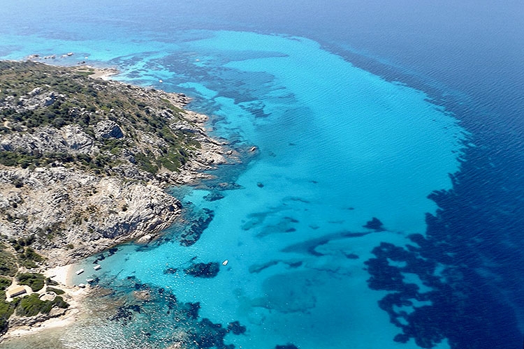
40° 51′ 00″ N; 9° 40′ 00″ E
The sandy shore and the pink granite rocky coast bathing in emerald
waters form an arc protected by promontories close to the Ghjlgolu pond that is
populated by herons, cormorants, ducks and other birds. This stretch of
coastline, rich in inlets and ravines perfectly sheltered from Sirocco,
features imposing rocks carved by the erosion of wind and sea; some of them
have zoomorphic forms, in particular the Cock of Gallura with the view of the
Tavolara island in the background.
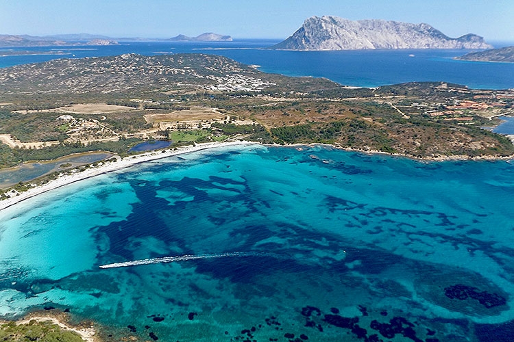
40° 50′ 00″ N; 09° 43′ 00″ E
Capo Coda Cavallo, right in the marine park, offers an unmatched
panoramic sight of the Molara and Tavolara Islands. The bay, bordered by a
strip of white sand closed to the east by the island of Proratora, is
surrounded by lush vegetation, scents and colors which are typical of the
Mediterranean maquis. This natural amphitheatre creates a perfectly sheltered oasis
protected from the Sirocco.
40° 46′ 00″ N; 9° 40′ 00″ E
The Brandinchi beach is also called Tahiti because of the exotic looking
of the white sandy beach thanks to which the seabed colors vary between
turquoise and emerald; the beach is surrounded by a thick Mediterranean
vegetation of pine, juniper, eucalyptus and acacia trees.
Located between Punta Sabbatino and Capo Coda Cavallo, Cala Brandinchi
is in front of the Ruija island that with its red granite rocks completes the
bay landscape with colors that take on intense reddish hues at sunset.
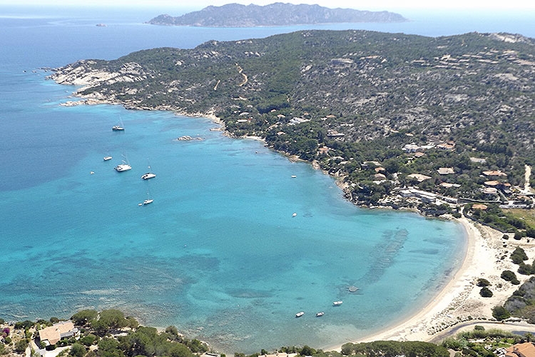
40° 49′ 00″ N; 9° 41′ 00″ E
Just south of Brandinchi, Lu Impostu offers a breathtaking view of the
thick vegetation surrounding the ponds and the dunes contiguous to the beach,
which together make a natural work of art, one of the main sights of the area.
Sea thistles, wild lilies and mimosa spread along a 1 km long strip of sand.
The sandy seabed with turquoise variations is an optimal anchoring site
sheltered from the Mistral.
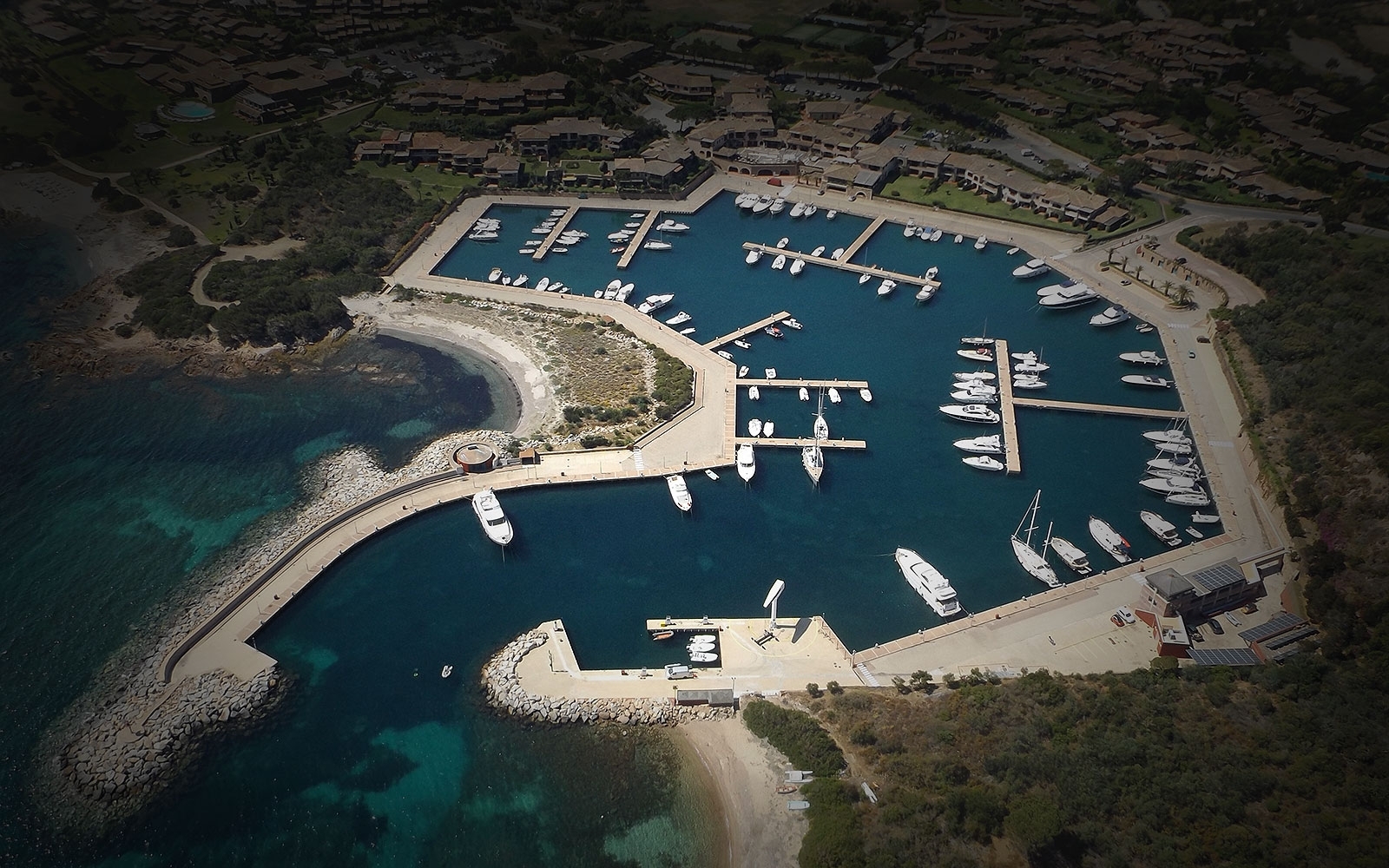
40° 48′ 00″ N; 9° 41′ 00″ E
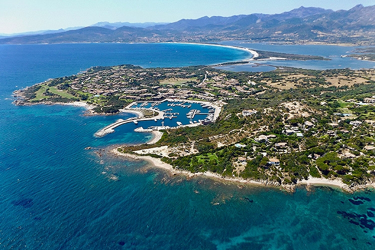
In a wild and harsh territory, covered
in a vegetation with the colors and scents of the Mediterranean maquis,
Puntaldia is a perfectly maintained residential complex blending in with its
surroundings and overlooking one of the most beautiful stretches of the
Sardinia coastline.
Puntaldia offers all the services in a safe and friendly environment, including golf, tennis, paddle, five-star hotels, restaurants, bars, and luxury stores...
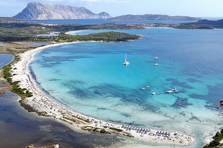
40° 47′ 00″ N; 9° 40′ 00″ E
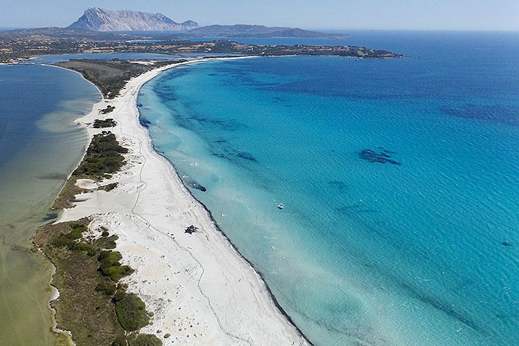
Located between Puntaldia and San Teodoro, La Cinta is one of the most
spectacular sights of this part of Sardinia. The white sandy beach stretches out in an
arched shape for about 5 km and separates the turquoise sea from the lagoon
behind which offers unexpected surprises to birdwatchers, such as several
specimens of pink flamingos, coots, little terns, herons and mallards.

